 |
This write up is not intended to be a trip report, but rather a collection of useful links and information for anyone planning to tackle the Wonderland Trail in 3 days.
The trail has 3 major trail heads that are car accessible and somewhat evenly spaced. If you are willing and able to finish the adventure in 3 long days you will be able to stay in front country campgrounds and you will not have to apply / compete for back-country campsites. You do however need a national park pass for your party. You will also need a kind soul who is willing to move your vehicle and the camping gear around the mountain as you run. Each day will require approximately 2-3 hours of driving - longer if your timing is off and you get stuck in a lineup upon re-entering the national park.
We decided to do our circumambulation of glorious Mt Rainier in a counter-clockwise fashion although the opposite direction seems to be somewhat more popular. Two main factors influenced this decision. The climbs are steeper and the descents slightly more gradual on average if you choose to go counter-clockwise. Personally I don't mind steep climbs and my knees and ankles appreciate a slightly more gentle grade on the descents. Also, starting from Mowich lake in a counter-clockwise direction makes for a longer and tougher first day followed by 2 slightly shorter and easier days.
Our itinerary:
One Day before the start of the adventure:
We drove to Mowich lake from Vancouver B.C. with a short stop for some grocery shopping along the way. Upon our arrival we went for a short hike. The road to Mowich lake is gravel for the final 24 km. There are some sizable potholes, but you will not require an all wheel drive vehicle. Just take it slow and you'll get there eventually. We were lucky enough to be traveling in a camper van and we just slept in the van in the parking lot. I am not sure whether or not this is technically permitted, but it seems to be fairly common for people to spend the night in their vehicle. The camping spots at Mowich lake are non-reservable and are allocated on a first come first served basis. I would have felt bad if we had pitched a tent and taken a spot from a hiking party that had no other option, but to tent.
 |
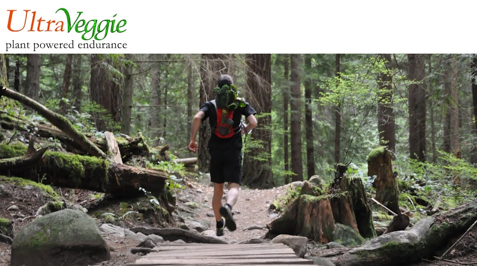
| Nice day for a run. Crossing the South Mowich River. |
53.8 km 2726 m of elevation gain according to Strava
Cougar Lake campground is right along the Wonderland trail a couple of kilometers past Longmire.
 |
| Tahoma Creek Suspension Bridge. Watch for missing boards (unlike me). |
 |
| Indian Henry's Hunting Ground. |
44.2 km 2379 m of elevation gain according to Strava
When following the Wonderland trail you reach the Fryingpan Creek trailhead after the long descent from Panhandle gap. This is the highpoint of the Wonderland Trail. Make sure to check snow conditions and consider crampons.
 |
| One of the Reflection Lakes. |
 |
| Snow remnants around Panhandle Gap. |
 |
| Glorious views upon reaching Summerland. |
Day 3: Fryingpan Creek to Mowich Lake
approximately 44 km 2850 m of elevation gain according to Strava
The Strava file is missing the first 3.5 - 4 km of the day (from Fryingpan Creek to White River due to a user error aka me forgetting to start the recording).
 |
| Spray Park. So worth it. |
We drove back home almost immediately after finishing the run. I was very grateful however that I was not the designated driver, since I was very knackered after running just under 30 hours in 3 days.
 |
| Singletrack paradise. Spray Park. |
Water along the trail is relatively frequent. Most back-country camps have a water source nearby. I carried two water bottles and a small filter with water treatment pills serving as an emergency backup. If there is an extended dry period / drought things might look different though. The longest stretch without water was the climb out of Box Canyon (where there is an actual water fountain by the road) to Indian Bar campground (12.2 km).
 |
| Reaching Indian Bar ... and Water. |
The Wonderland Trail is relatively easy to follow. Mostly there are signposts at any intersections or campgrounds. The only place where I got slightly tangled up was while crossing through the White River Campground. It's essentially a straight shot and the trail starts gaining elevation and disappears into the forest after you pass to the right of a wooden patrol cabin. You will still want to carry a map to help you get your bearings when you are second guessing which way to go. I personally carried this National Geographics map and my friend used some of the more detailed maps taken from the Hiking the Wonderland Trail book by Tami Asars, which is also an excellent and complete resource if you are interested in embarking on this adventure. It contains a wealth of information and maps even though all the trail descriptions are for travel in a clockwise direction. A third option could be to use these printable topographical PDF maps (full disclosure: I have yet to test these personally).
Here is a link to a trip report with stunning photography to get you psyched about visiting Mt Rainier.
National Park Service info on Mt Rainier and the Wonderland Trail. Closer to your departure date you will also want to make sure to monitor both the weather forecast, road closures and trail conditions to find out about washed out bridges, lingering snow and other problems.
More lodging options aside from the car campgrounds and the 2 lodges within the park.
Here is a nifty custom Wonderland itinerary planner that let's you choose a starting and end point and the number of days you are planning to be traveling.
Happy Trails,
Marc